Introduction
Effective river monitoring is essential for water resource management, flood prevention, and environmental protection. As water authorities face increasing demands for real-time data and rapid response capabilities, traditional manual monitoring methods are no longer sufficient.
Many river monitoring projects still rely on periodic inspections and fragmented data collection, making it difficult to obtain continuous visibility into changing hydrological conditions. By combining radar sensing technology, remote telemetry, and cloud-based monitoring platforms, water management agencies can achieve 24/7 visibility into river water levels, flow rates, and on-site conditions. This approach supports more informed decision-making and improves the efficiency of water resource allocation.
Challenges in Traditional River Monitoring
1. Lack of Continuous Monitoring
Conventional monitoring methods often depend on manual inspections and periodic data collection, making it difficult to maintain around-the-clock awareness of river conditions. This can result in delayed detection of abnormal water levels or sudden flow changes.
2. High Deployment and Maintenance Costs
Covering large river networks requires multiple monitoring stations. Traditional monitoring systems typically involve significant infrastructure investment, installation work, and ongoing maintenance, increasing overall project costs.
3. Delayed Response to Hydrological Events
Without real-time monitoring and automated alerts, authorities may struggle to respond quickly to flooding risks, sudden water level changes, or other emergency situations.
An IoT-Based River Monitoring Solution
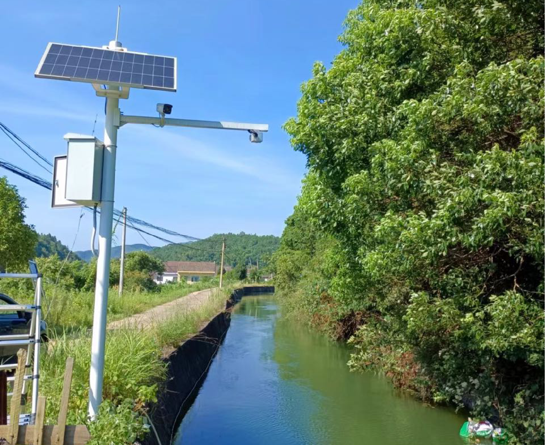
Modern river monitoring systems integrate radar sensors, remote telemetry units (RTUs), cameras, and cloud platforms into a unified architecture.
A typical deployment consists of:
-
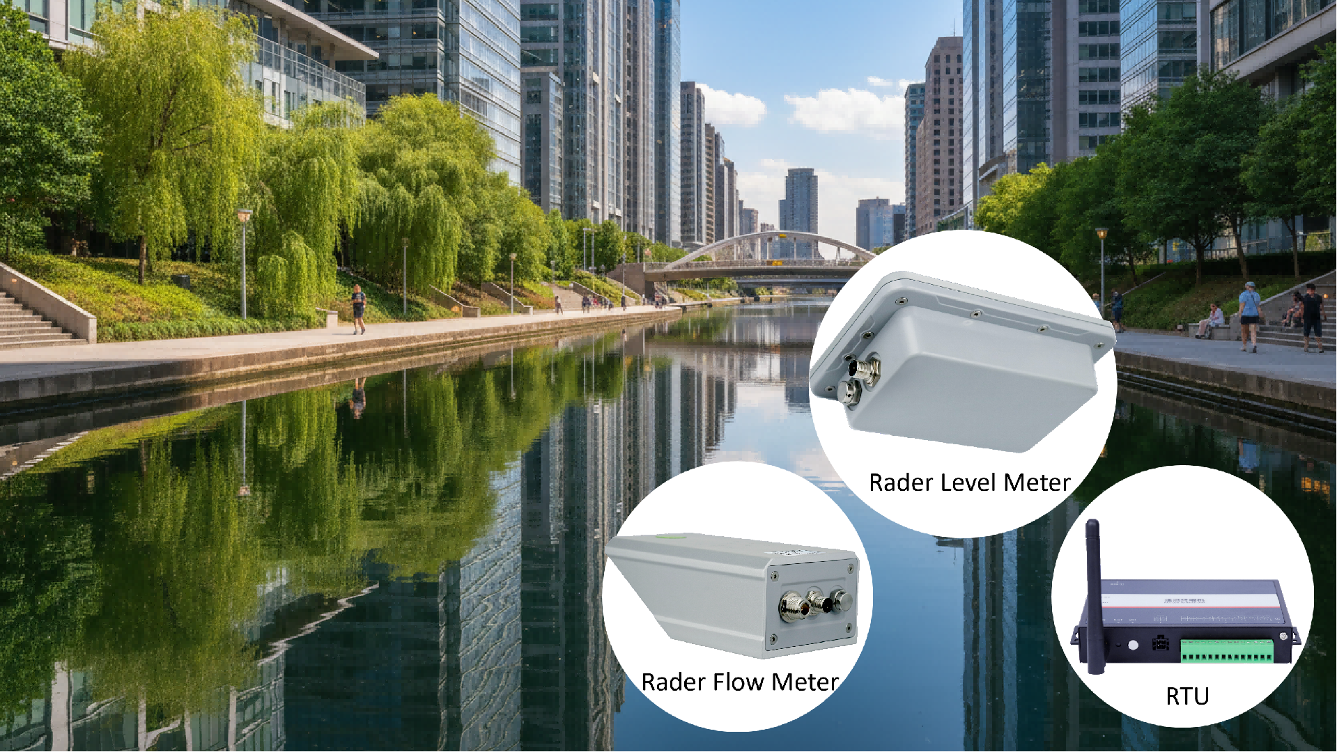
Radar flow meters for measuring water velocity and flow rate
-
Radar level meters for monitoring water level changes
-
Remote Terminal Units (RTUs) for data acquisition and wireless transmission
-
Cameras for real-time visual monitoring
-
Solar power systems for off-grid operation
-
Cloud-based monitoring platforms for centralized management
The monitoring station continuously collects hydrological data and transmits it wirelessly to a central platform, enabling unattended operation and remote supervision.
Key Components of the Solution
Radar-Based Water Level Monitoring
Traditional contact-based sensors can be affected by sediment, debris, corrosion, and changing environmental conditions. Radar level measurement technology offers a non-contact alternative that delivers reliable and accurate water level data in demanding outdoor environments.
The Hongdian Flat Panel Radar Level Meter is designed for continuous water level monitoring in rivers, reservoirs, canals, and drainage systems. Its radar-based measurement technology enables stable performance while reducing maintenance requirements.
Radar Flow Measurement
Accurate flow measurement is critical for water resource planning, flood forecasting, and hydraulic management.
The Hongdian 1922-24 Radar Flow Meter combines water level and velocity measurement capabilities to provide real-time flow monitoring without direct contact with the water surface. This approach helps improve measurement reliability while minimizing maintenance requirements in challenging field environments.
Reliable Remote Data Transmission
Collecting data is only one part of the monitoring process. The information must also be transmitted securely and reliably to supervisory platforms.
The Hongdian H1951 Remote Terminal Unit (RTU) serves as the communication hub of the monitoring station. It gathers data from radar sensors and other field devices and transmits the information wirelessly to remote monitoring centers. This enables operators to access real-time measurements, historical trends, and alarm information from anywhere.
Centralized Smart Water Management
Beyond field monitoring devices, a centralized management platform is essential for large-scale deployments.
The Hongdian Smart Water Management Platform supports:
-
Device management
-
Permission and role management
-
Station grouping
-
Data visualization
-
Historical data analysis
-
Third-party platform integration
-
Remote operation and maintenance services
By integrating sensors, RTUs, and cloud-based management tools, operators can efficiently manage distributed monitoring sites from a single platform.
Benefits of IoT-Based River Monitoring
Reduced Deployment Costs
Pole-mounted installation and solar-powered operation help minimize civil engineering work and simplify deployment in remote locations. Non-contact radar measurement technology further reduces maintenance requirements and long-term operating costs.
Reliable 24/7 Operation
Radar-based sensors are designed to operate in harsh outdoor environments and are less affected by temperature changes, wind, sediment, or sewage corrosion. This ensures stable long-term performance in river monitoring applications.
Real-Time Monitoring and Early Warning
Continuous data collection enables operators to track water level and flow trends in real time. When thresholds are exceeded, monitoring systems can increase data collection frequency and issue alerts, helping authorities respond more quickly to potential risks.
Applications
This solution can be deployed in a wide range of water management scenarios, including:
-
River channel monitoring
-
Flood warning systems
-
Reservoir monitoring
-
Irrigation networks
-
Drainage systems
-
Smart water conservancy projects
-
Environmental monitoring programs
Conclusion
As water authorities continue to modernize infrastructure and improve operational efficiency, real-time river monitoring is becoming an essential component of smart water management.
By combining radar sensing technology, wireless communications, RTUs, and cloud-based management platforms, organizations can achieve continuous visibility into river conditions, reduce maintenance costs, and respond more effectively to changing hydrological events.
Whether monitoring water levels, measuring flow rates, or managing distributed monitoring stations, IoT-enabled river monitoring solutions provide the foundation for smarter, more efficient water resource management.